Thursday, December 31, 2009
Beyond the Pale
Where there is uncertainty, man is quick to insert anything to plug the void. Remain sceptical at all times. Or should that be 'sssceptical'?.
Full article here :
http://politically-confused.blogspot.com
Wednesday, December 30, 2009
What Did The Ancients Think Of Spirals


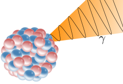
Artist's impression of an emission of a gamma ray (γ) from an atomic nucleus

Artist's representation of M33 X-7: a binary system in the nearby galaxy M33, containing a massive blue star feeding material to a black hole surrounded by a small accretion disk.

An artist's concept of a close Algol-type binary. The relative size of the Sun is illustrated by the small circle to the upper right of the figure. Illustration courtesy of M. Richards.
Sunday, December 27, 2009
Astral Mystery @ St. John's Chancel Ceiling
Parishioners at one of Canada's oldest Anglican churches will be puzzled by an enduring enigma when they gaze heavenward this Christmas.Astral mystery endures in Nova Scotia churchThe mysterious chancel ceiling at St. John's Anglican Church in Lunenburg, N.S., was reconstructed in 2004 after a fire three years earlier. While locals now know what the star pattern represents, they don't know who originally designed it, or how. (CBC)
The chancel ceiling at St. John's Anglican Church in Lunenburg, N.S., has a special pattern of gilded stars on it, and while locals now know what it represents, they have yet to find out who originally designed it, or how.
The conundrum emerged after the church, built in 1754, burned on Halloween night in 2001 as a result of arson. The parish sought to reconstruct the building's interior as closely as possible, and it brought in parishioner Margaret Coolen in 2004 to re-create the ceiling over the altar.

But the church didn't have a complete set of photographs of the original star pattern, so Coolen, hoping the pattern reflected the actual alignment of heavenly bodies in the night sky, sought the help of astronomer David Turner of Saint Mary's University in Halifax.
That's when the first mystery emerged.
Turner recognized the constellation Perseus in the photos of the eastern part of the chancel ceiling. But Perseus, seen from Lunenburg, always lies in the northern part of the sky and never due east.
"We looked at them and didn't recognize any of the star groups," Coolen explained of the constellations' positions. "It looked like they might just simply be put up at random, but it didn't seem like someone would go to that trouble to put just random stars on the ceiling."
Coolen suggested that Turner instead look at the stars' alignment around 2,000 years ago — on Christmas Eve in the year of Jesus' birth.
Then, using software that plots the positions of heavenly bodies throughout history, Turner had a revelation: The chancel ceiling's pattern indeed reflected quite closely how the night sky would have looked from Lunenburg all those years past, when constellations appeared in somewhat different locations than today.
"I set the scene for sunset, and bingo! I found myself looking at Perseus in the eastern sky," he said.
But while the finding has excited parishioners at St. John's Anglican, who now know that they are gazing up at the heavens as they would have appeared on the eve of their Saviour's birth, it has also perplexed them.
The ornamentation they once merely called "Mariner's Sky" holds a stellar motif of immense astronomical significance. But who could possibly have calculated the astral positions, and how, remains a mystery. http://www.cbc.ca/canada/nova-scotia/story/2009/12/23/ns-lunenburg-church-ceiling-star-mystery.html?ref=rss
Thursday, December 10, 2009
Bedford Barrens Petroglyph
Date: n.d., pre-1500 A.D.
Place: In situ: Bedford, N.S.
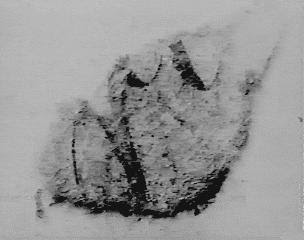
This petroglyph, or rock carving, was cut with stone tools, probably pre-dating the introduction of European-made metal tools, beginning about 1500. Hence it includes the earliest surviving human or humanoid figure of or by a Mi'kmaq. The eight-pointed star occurs in Mi'kmaq hieroglyphic writing as a symbol for the sun. The knobbed crosses occur elsewhere as part of the hieroglyph for 'star'. http://museum.gov.ns.ca
Other Mi'kmaq petroglyphs: Kejimkujik National Park, N.S.
This is the earliest photographic record of Mi'kmaq rock art. Parks Canada has completed a catalogue of all known petroglyphs within the boundaries of Kejimkujik National Park.


"Perhaps some of the most important images portray men and women wearing the traditional clothing of the time. In some cases, these images show highly detailed double-curve designs decorating the clothing. Foremost among these images is the unique peaked hat traditionally worn by Mi’kmaw women. Over 60 petroglyphs depict these peaked hats, suggesting the importance of women in the matriarchal Mi’kmaw society. Since none of this clothing remains today, these images provide the only examples of the motifs used by the early Mi’kmaq, before they were influenced by the arrival of Europeans." http://www.muiniskw.org/pgHistory3b.htm


Molly Muise descendant of Philippe Mius
The Mi'kmaq chaperon is preserved today as part of the traditional regalia worn by women at Pow Wows. It is a Medieval European head-covering that invokes a time in history when all married women wore the hood in imitation of their queen, who was also a member of the grail family. http://www.thelibraryofhope.com/basketstories2.htm


This is not a realistic representation of the Milky Way, but a symbolic rendering of a road of supernatural power, a connection between worlds like the twisted frog's leg of the Hočąk Medicine Rite, the rotating, double helix pathway to the Otherworld. Note that the star embedded in the Milky Way has a single helix "power line" descending downward, just like Gottschall has the double helix descending downward from each of the solar-like discs. Two more examples of the "double helix" design are found from the Great Lakes region. The one above right is described as an "unidentified abstract symbol", and the more diamond shaped one on the right is from the Cliff Lake paintings. http://hotcakencyclopedia.com/ho.Gottschall.html
I recommend reading John Bear MacNeil's Basket Stories for Mi’kmaq Grail Alliance, Kelly's Mountain, Red Ochre Folk, Kluskap/Cronus Myth, The Medewewin Stone, Circle Cross, Et In Arcadia Ego, Pharoah Unas, Roi Perdu - the Lost King, The lost Ark of the Covenant, Norse-Mi’kmaq Alliance,The Dark Virgin, Circles of Mi’kma’ki, Membertou/Sagamo/ The knight Sagramore @ King Auther's round table, The Templar links & much more
Also see John Colman's work on NS ley lines & Mi'kmaq scripting language/ Egyptian Connection
Thursday, October 8, 2009
The Bottemless Pit

Map by Harold Wilkins who maintained that he drew the map from memory, having been shown Kidd's original chart.


The money pit was, to date, almost 200 feet deep, protected by an elaborate set of booby traps (underground channels to an ocean beach over 500 feet away), has been the subject of countless excavations since 1795 http://www.mysteriesofcanada.com/Nova_Scotia/oakisland.htmDiscovery of The Pit
1795 Daniel McGinnis came across a roughly circular depression in the ground. There was a tree standing above it was a tree whose branches had been cut in a way which looked like it had been used as a pulley. With legends of pirates in the area, McGinnis grab 2 buddies : John Smith and Anthony Vaughan. The next day they went back and started to dig:
Two feet below the surface they came across of layer of flagstones covering the pit. At 10 feet down they ran into a layer of oak logs spanning the pit. Again at 20 feet and 30 feet they found the same thing, a layer of logs. http://www.activemind.com/Mysterious/Topics/OakIsland/story.html1803 The men returned with Onslow Company (formed for the sole purpose of the search)
They quickly got back to 30 foot point that had been reached 8 years ago. They continued down to 90 feet, finding a layer of oak logs at every 10 foot interval. Besides the boards, at 40 feet a layer of charcoal was found, at 50 feet a layer of putty, and at 60 feet a layer of coconut fiber. http://www.activemind.com/Mysterious/Topics/OakIsland/story.html1849 The Truro Company got down to 86 feet only to be flooded switched to drilling core samples with encouraging results.
The drill probe found multiple layers of charcoal, putty and coconut fibre. 98 feet level, a spruce platform guarding two oak chests containing loose metal pieces was discovered.
Conclusion was that they had drilled through 2 casks or chests filled will coins. Drilling also mentions that three small gold links that are MIA.
1850 Truro Co returned to dig paralle pit and tunnel over into the money pit. Water rushed in, and pumps where where used to rid the water. Somone had notice during low tide, water was rushing out into Smiths Cove. This was the discovery of the artifical beach.
The booby Trap Artificial Beach
pit designers had created a drain system, spread over a 145 foot length of beach, which resembled the fingers of a hand. Each finger was a channel dug into the clay under the beach and lined by rocks. The channels were then filled with beach rocks, covered with several inches of eel grass, and then covered by several more inches of coconut fiber. The effect of this filtering system was that the channels remained clear of silt and sand while water was still allowed to flow along them. The fingers met at a point inland where they fed sea water into a sloping channel which eventually joined the Money Pit some 500 feet away. Later investigations showed this underground channel to have been 4 feet wide, 2 1/2 feet high, lined with stone, and meeting the Money Pit between the depths of 95 to 110 feet. http://www.activemind.com/Mysterious/Topics/OakIsland/story.htmlIn the attempts to block it off the flood filtering system via a coffer dam @ Smiths Cove, an older dam was found. Fate called in a storm and the dam was destroyed before the crew had a chance to drian the water & dismantle the channels.
The next plan was to dig another pit 100 ft inland in hope to plug the channel, which also came to a dead end, this was the last attempt of by the Truro Co.
1861 Oak Island Association. Cleared out the pit to 88 ft. with a new hole to the east to intercept the sea water - new shaft was dug out to120 feet without hitting the channel. To the west another shaft was dug to a depth of 118 ft in attempts to tunnel over into the Money Pit. Bailing water out appeared until the bottom fell out & the money pit droped down 15 ft.
"Cave-in Pit"
1893 Fred Blair & The Oak Island Treasure Company "Cave-in Pit" (Discovered in 1878) 350 feet east of the money pit. It became flooded at 55ft and abandoned
cave-in pit appears to have been a shaft dug out by the designers of the Money Pit perhaps as a ventilation shaft for the digging of the flood tunnel http://www.activemind.com/Mysterious/Topics/OakIsland/story.html
1897 they did manage to clear out the Money Pit down to 111. Where they could see the flood tunnel
attempt to seal off the flow of water from Smith's Cove by dynamiting the flood tunnel. Five charges were set off in holes drilled near the flood tunnel http://www.activemind.com/Mysterious/Topics/OakIsland/story.htmlnew set of core samples :
126 feet, wood was struck and then iron
130 and 151 feet and also between 160 and 171 feet a blue clay
gap between the blue clay layers, a cement vault was discovered. vault itself was 7 feet high with 7 inch thick walls
Inside the vault the drill first struck wood, then a void several inches high and an unknown substance. Next a layer of soft metal was reached, then almost 3 feet of metal pieces, and then more soft metal.When the drill was brought back up another twist was added to the whole mystery. Attached to the auger was a small piece of sheepskin parchment with the letters "vi"; "ui"; or "wi"; What the parchment is a part of is still in question http://www.activemind.com/Mysterious/Topics/OakIsland/story.html
All attempts by The Treasure Company met with failure due to flooding
1899 second flood tunnel from South Shore Cove1909 Franklin D. Roosevelt & Old Gold Salvage group (Captain Henry Bowdoin President) searched http://www.islandnet.com/~kpolsson/oakisle/oak1909.htm assumed treasure of pirate Captain Kidd along with : vice president Frederick Blair, treasurer L.H. Andrews, secretary G.D. Mosher, and a board director Captain John W. Welling. From Apr- Nov
1911- Old Gold Salvage and Wrecking Company ceases digging work on the island; Frederick Blair does not extend their permit. Rudolphe Faribault first geological report of the Oak Island region. limestone, gypsum, sandstone, and shale are most likely below thick overburden deposits at the east end of the island.
Collier's Magazine publishes an article by Henry Bowdoin calling the Money Pit a hoax, claiming the treasure and flood tunnel never existed.1922 Frederick Blair Journal of Commerce of Boston advertisment looking for someone to buy half interest in the Oak Island treasure hunt for $50,000
Bookbinder business in Halifax merges with Philip and Marshall company. The engraved stone slab is reported still at this location. (Searchs in 1933 and 1935 cannot find the stone anywhere.) http://www.islandnet.com/~kpolsson/oakisle/oak1909.htm
1931
Frederick Blair joins with Chappells Limited of Sydney, Nova Scotia. One of the company owners is William Chappell. Also with company are son Melbourne Chappell, brother Renerick, and nephew Claude Chappell. William tells Blair a secret he kept for 31 years: he noted traces of yellow metal or gold on a drill bit during 1897
http://www.islandnet.com/~kpolsson/oakisle/oak1909.htm

These timbers seem to have been from the original designers due to the fact that they were joined using wooden pins rather than metal. As will be seen later these timbers were only a small part of a much larger construction. http://www.activemind.com/Mysterious/Topics/OakIsland/story.html
1959 Bob Restall found at smiths cove a rock with "1704" inscribed

1965 Bob passed out and fell into the water at the bottom his son, and 4 other where over taken by some sort of gas, passed out and drowned.
1965 Bob Dunfield took up the dug & brought in heavy machines and yet another tunnel was found on the south side of the island. The shaft apparently went down to 45 and stopped, its purpose is unknown. More drilling determined that at 140 feet there was a 2 foot thick layer of limestone and then a forty foot void. At the bottom of the void was bedrock ( matched 1955 drills)- a large, natural underground cavern. Common with limestone.

Bod Dunfield
1967 wrought-iron scissors below the drains at Smith's Cove , scissors were Spanish-American
made in Mexico and they were up to 300 years old. Also found was a heart shaped stone.
1970 Triton Alliance - group formed by Blankenship
new cofferdam they discovered the remains of what appeared to be the original builders' cofferdam. The findings included several logs 2 feet thick and up to 65 feet long. They were marked every four feet with Roman numerals carved in them and some contained wooden pins or nails. The wood has been carbon dated to 250 years ago. http://www.activemind.com/Mysterious/Topics/OakIsland/story.htmlWestren end of the island - Two wooden structures where found along with wrought-iron nails metal straps 9 ft below the western beach - pair of leather shoes were unearthed.
1976 Borehole 10-X a 237 foot tube of steel sunk 180 feet northeast of the Money Pit
several apparently artificial cavities were found down to 230 ft Drilling results
A camera was lowered and returned with amazing images - three chests, various tools & human body. Divers where sent in but strong current and poor visibility made it impossible. The hole collapsed and never re-opened.
At the northwest corner of Mahone Bay, several miles south of Chester, Nova Scotia latitude 44 31' N, longitude 64 18' W.
Welling Triangle surfaced again in 1937, in exceptional circumstances. Gilbert Hedden, then excavating on the island, was shown a book on the subject of the buried treasure of Captain William Kidd, written by the English author, Harold T. Wilkins. In it was a map, bearing the following instructions:18 W and by 7 E on Rock http://www.btinternet.com/~keypress/OakIsland/Imagination/OI302.htm
30 SW 14 N Tree
7 by 8 by 4.

The most commonly accepted translation is as follows:
"has theorized is that even if someone eventually makes it to the bottom, they will only find a decoy pit. The original stone inscription found in the pit was deciphered as reading, "forty feet below 2 million pounds are buried." Keith Ranville, with his Native American background, has claimed to have re-deciphered the inscription and says it is actually pointing to Birch Island - 2 islands away from Oak Island. "
"The first triangle in the inscription points to Birch Island while the rest deals with engineering patterns. He believes that another tunnel possibly branches off from the money pit and finds its way to Birch Island " http://www.theastralworld.com/ancient-mysteries/oakislandmoneypit.php


